TOR_08: JUANFRÍA |
Conexión a red: NO |
Usos del Agua
GANADERO
Periodicidad de caudal
INTERMITENTE
| Municipio | TORRES DE ALBARRACÍN |
| Ubicación | La Juanfría |
| Coordenada UTM X | 625675 |
| Coordenada UTM Y | 4479280 |
| Altitud | 1355 |
| Dist. Población | Sin datos* |
| Origina Río/Arroyo | NO |
| Acceso | FÁCIL/TODO TERRENO/A PIE |
Datos del Agua
| Temperatura | -1 |
| L/SG | |
| Olor | |
| Color | |
| Sabor | DESCONOCIDO |
Autor de la información
VALENTÍN ORTEGA AGUIRRE
Fecha de toma de datos
10/11/2013
Uso Público Actual
MEDIO
Riesgo de Contaminación
| Falta de protección |
|
| Zona de ubicación | FORESTAL |
| Paso de ganado | SI |
| Maleza | NO |
| Zona Agrícola | NO |
| Filtraciones-Escorrentias | DESCONOCIDO |
| Vertidos |
|
Control Analitico
| Incluida en análisis |
|
| Fecha | |
| Calificación | DESCONOCIDA |
Pictograma
NO
Leyenda existente
Curiosidades
DECÍAN QUE SI ECHABAS UN HUESO DONDE CAÍA EL AGUA, A LOS DOS DÍAS SE LO HABÍA COMIDO
Observaciones
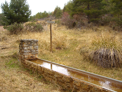
ES UN OJO DE TUBO ENGOMADO A LA FUENTE. 4 GAMELLONES DE CHAPA FORRADOS CON PIEDRA, 20 MTS.
Conservación
BUENA
Estructura
| Sistema de desinfección |
|
| Recogida de Agua | Sin datos* |
| Tipo de Fuente | FUENTE |
| Caño o Grifo | SI |
| Pila-Poceta | NO |
| Lavadero | NO |
| Sumidero | NO |
| Pavimentación | NO |
| Gamellón-Abrevadero | SI |
Material Gamellón-Abrevadero
METAL
Contexto Geomorfologico
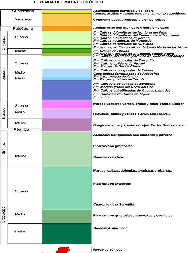
| Periodo Geológico | TRIÁSICO INFERIOR |
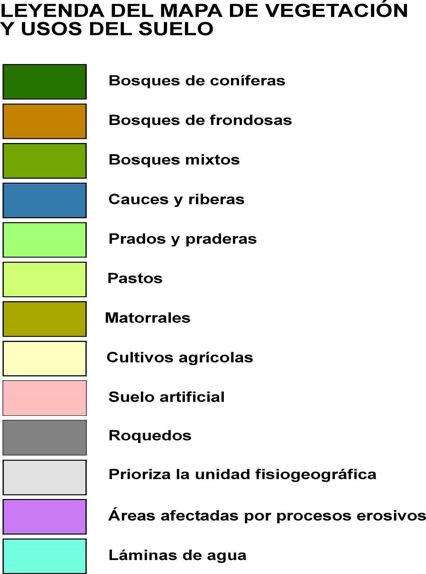
| Punto de ubicación | BOSQUES DE CONÍFERAS |
| Zona de ubicación | FORESTAL |
Fauna asociada
Fauna acuática asociada
Flora asociada
PINO SILVESTRE CON SABINAS. SOTOBOSQUE DE ESTEPAS, ENEBROS, ZARZAS, AGRACEJOS, ENDRINOS, ESPINOS. HERBÁCEAS Y JUNCOS ALREDEDOR.